|
Known as the New York Post Road for much of its history, due to its function, the White Plains portion was rebuilt sometime in 1838 to straighten it out. The east-west dividing line is Lexington Avenue, and the eastern portion was originally what is now Maple Avenue. It now connects to S. Broadway a block north of Maple, and runs south to Mt. Vernon.
0 Comments
Dating to 1854 if not earlier, it was originally known as Court Street, likely due to its being downhill from the court house. It was renamed in 1903 for one of two men named Hiram Paulding. One was the son of John Paulding (see Paulding Street) who had a distinguished naval career, becoming a Vice-Admiral. More likely it was local attorney Hiram Paulding, who served as village corporation counsel among other positions. He apparently had an affair with the police chief's sister-in-law, which is probably not a bright thing to do. It connects Hale Ave. and Paulding St. in the shadow of the Westchester mall.
Henry Tibbits bought 109 acres northwest of Post Road in 1847 and presumably built this street by 1858. It extends from Lynton Pl. (which was part of the original Post Rd.) to the train tracks. Henry's son Charles was one of the organizers of the Village Park Association, which was founded to care for the park in the center of Broadway which now bears his name. Another son, William, twice served as village president. 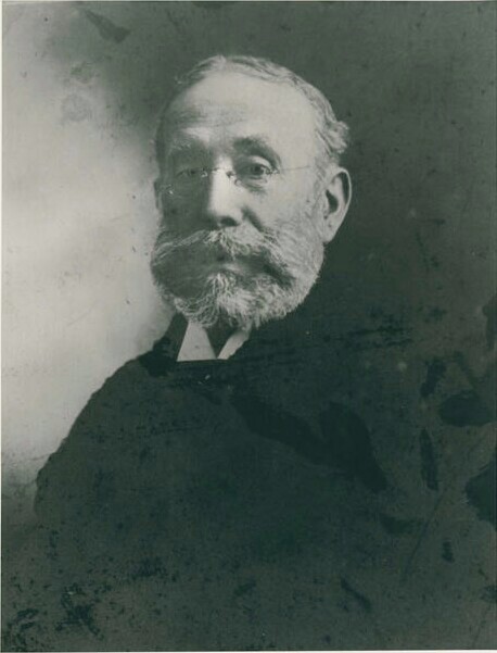 "Uncle Charley" Tibbits In 1844, the first railroad station (the New York and Harlem RR) was built along Orawaupum Street near the Dobbs Ferry Road. A cow path leading west from Broadway was soon developed into a road, which became known as Railroad Avenue. It was extended east to S. Kensico Ave. by 1905. Central Avenue ran into Railroad at Bronx St. The business district soon moved from Broadway to Railroad Avenue. In 1913, the entire road was renamed Central Avenue, much to the displeasure of just about everyone, and the following year, effective April 15, it was given its current name. It is worth noting that in 1907, it took 35 minutes for an express train from Grand Central Terminal to get to White Plains. In 2016 it takes 38 minutes.
Named for one of the Indian sachems who sold Quarropas to the Rye settlers, it was developed circa 1844 by the NY and Harlem Railroad, which placed the first train depot in White Plains here. It originally ran south from what is now Main Street and had been extended to Fisher Avenue by 1872 and Chestnut Hill Avenue by 1881. Finally, it was continued to Post Road by 1900. The road from the train station south to Fisher was made public in 1887 and in 1895 that was extended to Fairfield Ave. The portion between Fisher Avenue and Main Street was discontinued between 1977 and 1983 during the Urban Renewal period. 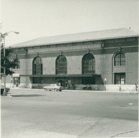 A later railroad station When built circa 1870, it was known as Clinton Avenue and then North Clinton Street at the time when Ross Street was called Clinton Street. When Ross was renamed in 1903, this was renamed to Clinton St. In any case, it was named for the first governor of the state of New York, and fourth Vice President of the USA, George Clinton. He also took part in the Battle of White Plains and was one of New York's representatives to the Second Continental Congress. The road goes east from N. Broadway past Beech Street and is interrupted by both the Cross-Westchester Expressway and the Central Westchester Parkway.
Built circa 1901, it is right at the border with Greenburgh, connecting Harvard Drive with Jackson Avenue. It was named for Col. Silas Newcomb, who led a regiment from New Jersey in the Battle of White Plains.
It was known as Battle Avenue when built circa 1901, but since we already had one of those, in 1903 it was renamed in honor of General Charles Lee of the Continental Army (also the namesake of Fort Lee, NJ). It was made a public road in 1922. Lee runs between Chase and Putnam Avenues.
In keeping with the theme of names on Chatterton Hill, this road is named for General Israel Putnam, who was in command of troops on Purdy Hill during the Battle of White Plains. Built circa 1895, it was made a public street in 1922.
Originally known as Lafayette Avenue, in keeping with the Revolutionary War theme in Vivian Heights, its name was changed to honor “Mad” Anthony Wayne, another Revolutionary War figure, in 1903. Also in keeping with the other streets there, such as Trenton, which it parallels, it was built in two parts, first circa 1895 to a bit east of Independence St. and the second in 1911 extending it to Whitney St.
Built circa 1895, it stretches from Central Avenue in Greenburgh roughly easterly until it passes Hawley St., and curves over to meet Wayne Avenue. However, it originally stopped just east of Independence St. and was extended in 1911. It was named for the Revolutionary War battle and made a public road in 1912 (the portion in the Lester subdivision east of Independence) and 1917 (the part in Vivian Heights).
Named for the Revolutionary War battle, in keeping with the theme of many of the streets on Chatterton Hill, the original part starting at a dead end west of Waldo Ave. and ending just east of Independence St. was built circa 1895 and it was extended to Whitney St. in 1911. The latter portion was made a public street in 1912.
Stretching east from Waldo Avenue to a paper street called Wright St., it dates to circa 1893, and its name continues the Revolutionary War theme.
Built circa 1893, it is another street in Vivian Heights with a Revolutionary War-themed name. It runs north from Concord Avenue, and while it originally was a dead-end street, it was extended to connect to Central Avenue circa 1913.
Partly in Greenburgh, this road was known as Alexander Hamilton Avenue, in honor his having fought on Chatterton Hill during the Battle of White Plains, when built circa 1891. The name was shortened in 1903 to avoid confusion with Hamilton Avenue.
Of three early roads on Chatterton Hill called that, this is the one which retained that name. It was built by 1867 and goes north from Battle Avenue to a dead-end north of School St.
Named for the Revolutionary War battle when it was first built circa 1855, it traveled south from Water Street to a dead end near the village line. Although it later stretched several blocks further north, in 1977 the northern terminus was returned to Water Street. On the south, it went near Prescott in 1900 and it now peters out south of Bolton Avenue. The dividing line between North and South Lexington is Main Street.
Originally known as Washington Street, it was renamed in 1903 after another Revolutionary War hero, Nathan Hale. It originally only traversed the area from Westchester Avenue to Hiram Street, but was extended to Livingston Ave. circa 1905. Hale was made a public road in 1911. The original portion of the street was discontinued in 1992.
During George Washington's time here for the Battle of White Plains and when he returned a couple of years later, brothers Cornelius and Isaac Oakley served as guides to him. Both also served as local officials; Cornelius as assessor and Isaac as pounder (something like a dog catcher, but for all animals) and sheriff. This road was regarded as an extension of what is now Franklin Ave. when built circa 1905, although they did not line up at S. Kensico Ave., the original eastern terminus of Franklin. This road was cut off by construction of the Cross-Westchester Expressway; a small piece remains east of the latter road, connecting to Belway Place.
On an 1867 map, three parallel streets appear running south from what is now Westchester Avenue: Paulding, Williams, and Van Wart Streets. They were named for the three men who captured Major Andre after he had been given the plans to West Point by Benedict Arnold during the Revolutionary War. They are not on an 1881 map and it is not clear the latter two ever existed. Williams Street gave way to the New York, Westchester, and Boston Railroad, while Van Wart Street would have been approximately where Bloomingdale Road is. Paulding was accepted as a public street from Westchester Avenue to Hiram Street in 1919 and from Hiram to what is now Maple Avenue in 1921. 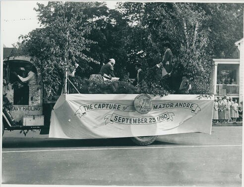 Future Treasury Secretary Alexander Hamilton commanded a cannon on Chatterton Hill during the Battle of White Plains and has two roads named after him, this and Alexander Avenue. Hamilton Avenue ended at Bronx St. when laid out circa 1855. It was connected to Tarrytown Road via a bridge over the river built in 1917. The street was also known as Lincoln Avenue for a while following the President's death.
This road, perhaps the most prominent on Chatterton Hill, was named for the Battle of White Plains, which took place largely on the hill. In this October 1776 Revolutionary War battle, the British army managed to dislodge the Continental Army from its positions on the hill, but Washington's troops were able to retreat to better positions in North White Plains. General Howe of the British army chose not to continue pursuing Washington, instead returning to New York City where he took Fort Washington, while the Continental Army made its way to Valley Forge. Battle Avenue was earlier known informally as Dobbs Ferry Road, and Chatterton Hill Avenue, and later as Battle Ridge Avenue, but got its current name in 1868.
During the early days of White Plains, there were two main east-west roads: the New York Post Road and the Dobbs Ferry Road. The latter's approximate course, dating to 1730, was west from North Broadway along what is now Rockledge Avenue, then south along Spring Street, which no longer exists, and then west along the present-day Main Street and over Chatterton Hill on Battle Avenue. In the nineteenth century, Rockledge was considered part of Spring Street, eventually being called Old Spring Street, and got its current topography-based name in 1903. The portion west of Cottage Place going to Spring Street was eliminated in 1976.
This road dates back to pre-Revolutionary War days and stretches northeast off North St. before curving southward and ending near Westchester Lane and Westchester Avenue. Before 1984 or so it was connected to Westchester Avenue. It was named for the Haviland family, which owned a farm in this area from the 18th to the 20th century.
|
AuthorMy name is Cliff Blau. I was born and raised in White Plains, NY, and in 2015 became interested in learning more about the history of this fair city. The pathway I took into White Plains history was to discover the reason for the names of each of the streets. See https://www.google.com/maps/d/viewer?mid=1WvlOinVQnWh4KGDmEN7YPFfg4II for an annotated map of White Plains. Archives
March 2024
Categories |
 RSS Feed
