|
Built early in the 20th century, it lost a major section west of its current terminus when the Bronx River Parkway was built. Its name may come from it being in a wooded area. The road travels northwest off Fisher Avenue and then curves both southwest and northeast.
0 Comments
Principally a Scarsdale road, beginning at Fenimore Road, it merges into Fisher Avenue together with Walworth Terrace. It was built into White Plains the early 20th century. The road is named for Reuben Hyde Walworth, who was New York State's final Chancellor, chief judge of New York's court of equity. He was nominated to the U.S. Supreme Court by President Tyler, but the Senate failed to act on the nomination.
Connecting Quinby and Tibbits Avenues, this road was built circa 1901. Its name seems to be based on the local topography.
A small dead-end road off Colden Avenue, it was originally named Linden Place when built circa 1900. The name was changed to Linwood in 1934 to avoid confusion with Lynton Place.
This road was called Schappert Place after a local family when begun circa 1900. At that time it was only between what are now Benedict and McBride Aves. A few years later a road called Hawthorne Street was built from the opposite side of McBride south to Griffin Place and eventually Schappert was renamed to Hawthorne. It became a public road in 1925. In 1966 or so, it became a discontinuous road when Orchard St. was rerouted, leaving a gap between Orchard St. and Orchard Pl.
This street was originally known as Prescott Avenue when built circa 1900, but since it didn't line up with the part of Prescott on the east of Soundview Ave., it was renamed in 1951. At the request of the Prospect Park Association, it was named after local philanthropist Clarion B. Winslow (1869-1947), who donated large sums to the White Plains Hospital and other local organizations. The road take a rather odd, meandering path from the intersection of New York and Vermont Aves., going southwest then southeast until it hits Park Road, then winds around to the northeast until it hits Soundview. It stopped at Pin Oak La. in 1908 but by 1914 it had its current length. 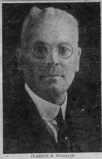 Built circa 1900, it connects Osborne St. and Prospect St. The source of the name is unknown.
Built circa 1900, it connects Oakley Road and Winslow Road. It is named for a type of tree.
When White Plains purchased various lots in North Castle to use for its reservoirs, it resulted in some rather uneven borders. At one point near Reservoir #1, White Plains juts out to the west into North White Plains. In 1932, the town of North Castle wished to extend a road known as Nethermont Avenue south, which would result in it passing through this odd section of White Plains, and the Common Council gave it permission to do so. The basis of the name is unknown.
With White Plains's population growing rapidly, the village acted to ensure an adequate water supply. In 1898 the village acquired the private water company known as the Westchester County Water Works Company, and the next year the Board of Water Commissioners, which had been buying privately held land in North Castle for the past few years, largely from White Plains resident Thomas Holden, commissioned the construction of a reservoir in North Castle, which was completed in 1900. Soon this supply was found to be insufficient, and in 1907, a second reservoir was added. Again, by the time it was finished, population growth rendered it inadequate, so arrangements were made to tap the New York City water supply, which remains our major water source. By 1910 the water commissioners had this road built by Reservoir #2, connecting to N. Broadway. The area around the reservoirs was annexed to White Plains when it became a city in 1916. Anyone reading the description of the city's northern border in the city charter will see it is hard to follow, and a dispute between White Plains and the town of North Castle had to be resolved by the County Board of Supervisors in 1931.
Except part of the above seems to be nonsense, since this road appears on a map from 1776, along with Old Road to Kensico, which goes along the east side of the reservoirs, and got its name from the fact that it went to the village of Kensico, which was flooded when the Kensico Dam was built. Minott Mitchell's home, originally on S. Broadway, was moved to this road and now serves as the American Legion headquarters. Mitchell, whose great-uncle was Roger Sherman signer of he Declaration of Independence, was an attorney in White Plains beginning in 1806 with an office right next to the courthouse. He also served as town clerk for nearly a quarter-century. Most importantly, he was president of the Athlete Base-Ball Club, organized May 7, 1866. His much-younger brother Josiah wrote the history of White Plains that appears in Scharf's History of Westchester County. The road was built circa 1900 and was accepted as a public road in 1915.
This was originally considered an extension of Fisher Ave. when that road was extended south from Tibbits Ave. to the village line circa 1898. In 1952, that extension was renamed Walworth Terrace, with the official reason being to avoid confusion, what with the fork where Fisher splits into this road and Walworth Ave. But why they thought calling Walworth Terrace wouldn't result in it being confused with Walworth Ave. is beyond me. It has been suggested that the real reason the name change was requested is that the portion of Fisher east of Tibbits was home to poor Negroes, and the people living near wealthy Scarsdale didn't want to be associated with them.
This was named Elm Place when it was built late in the 19th century and was renamed in 1903 in honor of Myndert Fisher's wife's family. Dennison Street was accepted as a public road in 1907. It connects S. Lexington Ave. and Orawaupum St.
Dating to the late 19th century, this road splits the territory between Longview and Davis Avenues going from Prospect St. to Maple Ave. The name seems to be tree-based.
Built circa 1899 as part of the Sound View Heights development, this street between Prescott and Coolidge Avenues was at first called Putnam Avenue. In 1922 it was renamed in honor Captain Frederick William Cobb (1875-1918), who was killed in action during World War I. Prior to the war, Cobb served on the village Board of Trustees.
A part of Oakley Rd. when the original section was built, ending at Ralph Ave., it was extended to S. Lexington Ave. circa 1920. In 1924 the road from Soundview Ave. to S. Lexington Ave. was renamed in honor of then-current President Calvin Coolidge. He is the most recent president to have a street named after him in White Plains.
This road was built circa 1899 and was presumably named for the same Oakley family as Oakley Avenue was. Curving around from Winslow Rd. to Soundview Ave., it originally included a portion of what is now Coolidge Ave. (up to Ralph Ave.)
Built circa 1899 in the Prospect Park neighborhood, it goes southeast off W. Post Rd., then forks off at right angles to connect to Vermont Ave. and Winslow Rd. It is named for the state.
Built circa 1899 in the Prospect Park neighborhood, it stretches between Prospect St. and Coolidge Ave., then curves around and goes roughly southwest until it runs into Winslow Rd. at New York Ave. It is named for the state.
When it was built, by 1900, between Main St. and what is now Franklin Ave., it was called Hillside Place. In 1903 its name was changed to Reynolds Place, but in 1929 it acquired its current name, for an unknown reason.
Built circa 1898, it got its name by 1900, source unknown. It runs behind Eastview Middle School from Franklin Ave. north to Main St. and connects there with Canfield Ave.
The Dusenbury family owned so much land on Purdy Hill that it was known for a time as Dusenbury Hill. This road, between Park and Rockledge Avenues, was built circa 1897.
Begun circa 1897 and finished some 30 years later, it goes north-northeast from Kensico Pl. to connect with Sunset Dr. near Hall Ave. Part of it was originally called Hillcrest Ave. but had its current name by 1904. It was made a public road in 1906. The name is one of those that combines two words for geographic features.
Built circa 1897, it runs southwest off Rathbun Ave. before shifting to a northwest path to Maple Ave. It once went to W. Post Rd., but that portion was officially discontinued in 1996. The reason for the name is unknown.
|
AuthorMy name is Cliff Blau. I was born and raised in White Plains, NY, and in 2015 became interested in learning more about the history of this fair city. The pathway I took into White Plains history was to discover the reason for the names of each of the streets. See https://www.google.com/maps/d/viewer?mid=1WvlOinVQnWh4KGDmEN7YPFfg4II for an annotated map of White Plains. Archives
March 2024
Categories |
 RSS Feed
