|
Known as Colonial Place when built circa 1908, it was renamed Chadwick Place in January 1934 to go with Chadwick Rd, but in September of the same year it was changed to Stafford Place to honor Fred P. Stafford. Stafford had been one of the developers of the area and had died in 1933. It runs SE and NW between Chadwick Rd. and Gilbert Pl. It was made a public street in 1932.
0 Comments
Called Colonial Terrace when built circa 1908, Chadwick was extended north of what is now called Stafford Place circa 1927, although that extension was known as Stang Avenue originally. That part was renamed Colonial Terrace in 1933, then the whole street was given its current name in 1934. It became a public road in 1932. The basis of the name is unknown. It starts at the southern part of Garretson Rd. and dead-ends at the north near a paper street known as Bernard Pl.
Built circa 1908, Garretson starts at Orchard St. and goes east, then north until it connects up with Gilbert Pl. It became a public road in 1932. The reason for the name is unknown. Gilbert takes a sort-of S shaped route from Chadwick Rd. to the north end of Garretson Rd. It was built circa 1908 and became a public road in 1932. The basis of the name is unknown, although it is possibly named for developer Arthur Todd's great-grandmother Rebecca Gilbert Todd. This is primarily a Scarsdale road which was extended into White Plains by 1907. It connects to Winslow Rd. just over the border. It was the centerpiece road of a development in Scarsdale called The Grange built by Cornelius Fish. The name doesn't seem to refer to a particular park although there was a Delecta Park in that area of Scarsdale.
It starts at Cloverdale Avenue in the east, and was originally intended to go through to Haarlem Avenue, but when Holland Park was redeveloped into the North White Plains development, it was terminated at N. Broadway. The road is named in honor of the family which owned 180 acres of land in this area during the late 19th and early 20th centuries.
Originally called Clinton Avenue when built circa 1907, it was renamed in 1929, probably to avoid confusion with Clinton Street. Why Otis was chosen is unknown. It is a short road between N. Broadway and Harwood Ave.
One of three parallel streets in the North White Plains development (which was originally known as Holland Park), Cloverdale was originally named Third Street, but was changed to its current name by the new developer, New York Suburbs Co. in 1907, there already being a Third Street. Why this name was chosen is unknown.
The middle of the three parallel roads between Holland Avenue and N. Broadway, Seneca began as Second Street and was renamed Chester Avenue in 1907. Finally, in 1923 it was changed to its current appellation in honor of the Indian tribe. Another of the three parallel roads between Holland Avenue and N. Broadway, Harwood was originally known as First Street and was renamed in 1907. The name seems to be based on Clifford Harmon, the president of the New York Suburbs Co. and his mother's maiden name, Wood. Begun as part of Holland Park circa 1907, it goes east from N. Broadway to Harwood Avenue and then turns southeast to end at an intersection with both Holland Avenue and Seneca Avenue. The name is one of those formed by combining two geographic terms.
Holland Avenue was laid out circa 1907 as part of the subdivision originally known as Holland Park, and is named in honor of the province in the Netherlands. It traverses from Haarlem Avenue in the west until it reaches a dead end just before the Central Westchester Parkway in the east.
Haarlem Avenue, which runs along the Metro North train tracks, stretches from Holland Avenue in the south to Fisher Lane in the north, and is one way (going north) from Holland to Bond St. It was built circa 1907 and the name refers to the city in the Netherlands, in tribute to New York's beginning as New Netherlands. As previously noted, this was originally considered a part of what is now called Van Wart Avenue, until it was renamed in 1970 since there is a gap of several blocks between the two roads. It goes only between Bogert Ave. and Greenacres Ave., although originally it was supposed to stretch beyond Fisher Avenue. There is also a paper street component to it, most of which was demapped in 2016 but a small bit remains off Linwood Pl.
First laid out in 1892, it was originally only two blocks long, between Quinby Avenue and what is now Greenacres Way. Its name at the time was Summit Place, and it was later changed to High Street, which was accepted as a public road in 1922. In 1927 the city renamed it Greenacres Avenue after the area of Scarsdale that borders on White Plains. The road was extended into Scarsdale by 1910.
In 1907, there was a faction in the village of White Plains advocating for the creation of a city, and a committee was formed to draft a charter. The proposed borders in the plan included the territory encompassed by the village and town of White Plains, as well as the Greenacres section of Scarsdale, most of West Harrison, some of North White Plains, and a chunk of Greenburgh out to where the Crossroads Shopping Center now stands on Tarrytown Road. Laid out in 1907, it runs alongside the New York-Presbyterian Hospital grounds between Westchester Avenue and Mamaroneck Avenue. When the hospital was built in 1893, it was called the Bloomingdale Hospital, which name derives from the New York City road the original hospital was on. Bloomingdale Road was accepted as a public street in 1917. The road was constructed by the hospital and Joshua Sprague, who developed the Carhart neighborhood.
A companion road to Upland Ave., it was begun circa 1906 going north off Woodcrest Ave. and later connected to Hall Avenue circa 1925, becoming a public street in 1927. It is on low land, hence the name.
First laid out in 1906 and later extended north, it is a double-curved road off Woodcrest Ave. Its name derives for it being on high land. Upland Avenue was made a public road in 1927.
This road was started circa 1906 and extended in 1910, the source of the name is unknown. It goes east from S. Kensico Ave. and ends at Minerva Dr. since the Cross-Westchester Expressway was built.
Samuel Lyon was a successful real estate and insurance attorney who lived on what would become Lyon Place. He bought Minott Mitchell's law office and later moved it to Railroad Avenue when the new courthouse was opened. That same office was later used by William Robertson. Lyon Place was laid out circa 1906 and travels from Waller Ave. to S. Broadway.
Gilbert Lyon, who lived on the opposite side of S. Broadway, served six years as town supervisor, five as county treasurer, and one year as village president, being elected to another term in 1878 which he was unable to serve. Tony (or Toney) Richards bought the Ferris estate and laid out this road and Richards Street circa 1905. It parallels Ferris Avenue from Richards to Park Avenue. The name seems to be based on the nice view from the area.
Built and self-named by contractor Toney (or Tony) Richards circa 1905. He planned to extend it further east but that portion was discontinued in 1964. Richards was the man responsible for paving many of the roads in the unincorporated section of White Plains in the early 20th century.
Near the northern border of White Plains off North Broadway, it was named in honor of a family which lived in the area prior to the Revolutionary War. Built circa 1905. 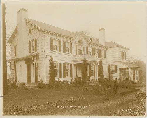 When built between McBride Avenue and Griffin Place circa 1905, this road was called Brookview St. but was soon renamed. The basis for the new name is unknown.
Built circa 1905, it runs north-northeast off N. Broadway before curving southeast to meet Orchard St. The reason for the name is unknown. It was made a pubic road in 1925.
CARHART AVENUE, WALLER AVENUE, DEKALB AVENUE, MARION PLACE, SCHUYLER PLACE, EDGEWOOD STREET3/11/2017 The Carhart neighborhood was developed by Joshua M. Sprague in 1905 and 1906. Carhart and Waller Avenues are named after local land owners. James Waller owned the land between Post Road and Maple Avenue from Mamaroneck Avenue to South Broadway, while Louisa Carhart owned the land on the other side of Maple going south to the intersection of Bloomingdale Road and Mamaroneck Avenue. The other streets in the neighborhood were named for Revolutionary War figures. Baron DeKalb was in White Plains when Washington was headquartered near here during the war. DeKalb Avenue originally ran only from Edgewood to Maple and was extended to Mamaroneck Avenue in the 1920's.; the portion between Edgewood and Schuyler was discontinued in 1968. General Francis Marion was known as the Swamp Fox, while General Philip Schuyler commanded the American troops in the victory at the Battle of Saratoga. The section of Schuyler from DeKalb to Mamaroneck Avenue was accepted as a public road in 1964. The portion of Schuyler from South Broadway to Mamaroneck Avenue was discontinued in 1989. Edgewood is the oddball name; the road was originally called Putnam Place, after the general in charge of New York's troops in the revolution. It was renamed in 1922 because there were other streets in White Plains named for Putnam (two of which have since been renamed Byron and Cobb Avenues), and the significance of the current name, if any, is unknown.
Built circa 1905, it was named for Colonel A. B. Crane, who owned most of the land on the north side of the road in the early 20th century. For some reason, it was also known as Miller Place for a brief time around 1910. It goes northeast from N. Broadway before turning northwest and terminating at Lenox Avenue.
Connecting Prospect St. and Linda Ave., this road dates back to circa 1905. The source of the name is unknown.
A one-block road traveling between S. Lexington and Howard Aves., it was named for developer Ora Howard's wife Charlotte when built circa 1905.
Built circa 1905 by its namesake, real estate developer Ora Howard, it runs southeast from Osborne St. to Charlotte St. then south to Byron Ave.
|
AuthorMy name is Cliff Blau. I was born and raised in White Plains, NY, and in 2015 became interested in learning more about the history of this fair city. The pathway I took into White Plains history was to discover the reason for the names of each of the streets. See https://www.google.com/maps/d/viewer?mid=1WvlOinVQnWh4KGDmEN7YPFfg4II for an annotated map of White Plains. Archives
March 2024
Categories |
 RSS Feed
